I’ve been writing about sanctuaries recently, and in this field it really stands out how few names of ancient sites we know for certain. Pietrabbondante, Rossano di Vaglio, Campo della Fiera, Grotta Poesia – all are known by Italian names because their ancient names are not known. The inscriptions found at the site do not name the site itself or the community which had responsibility for the sanctuary, and there is no clear match in ancient literature.
That hasn’t stopped people trying to name these sites. Excavator Simonetta Stopponi is clear that she thinks that the major Etruscan sanctuary she has found at Campo della Fiera is the Fanum Voltumnae described by various authors as the main meeting place of the Etruscan league. (You can see some of the artefacts found here – note also that this exhibition is very sure of the identification of the site.)
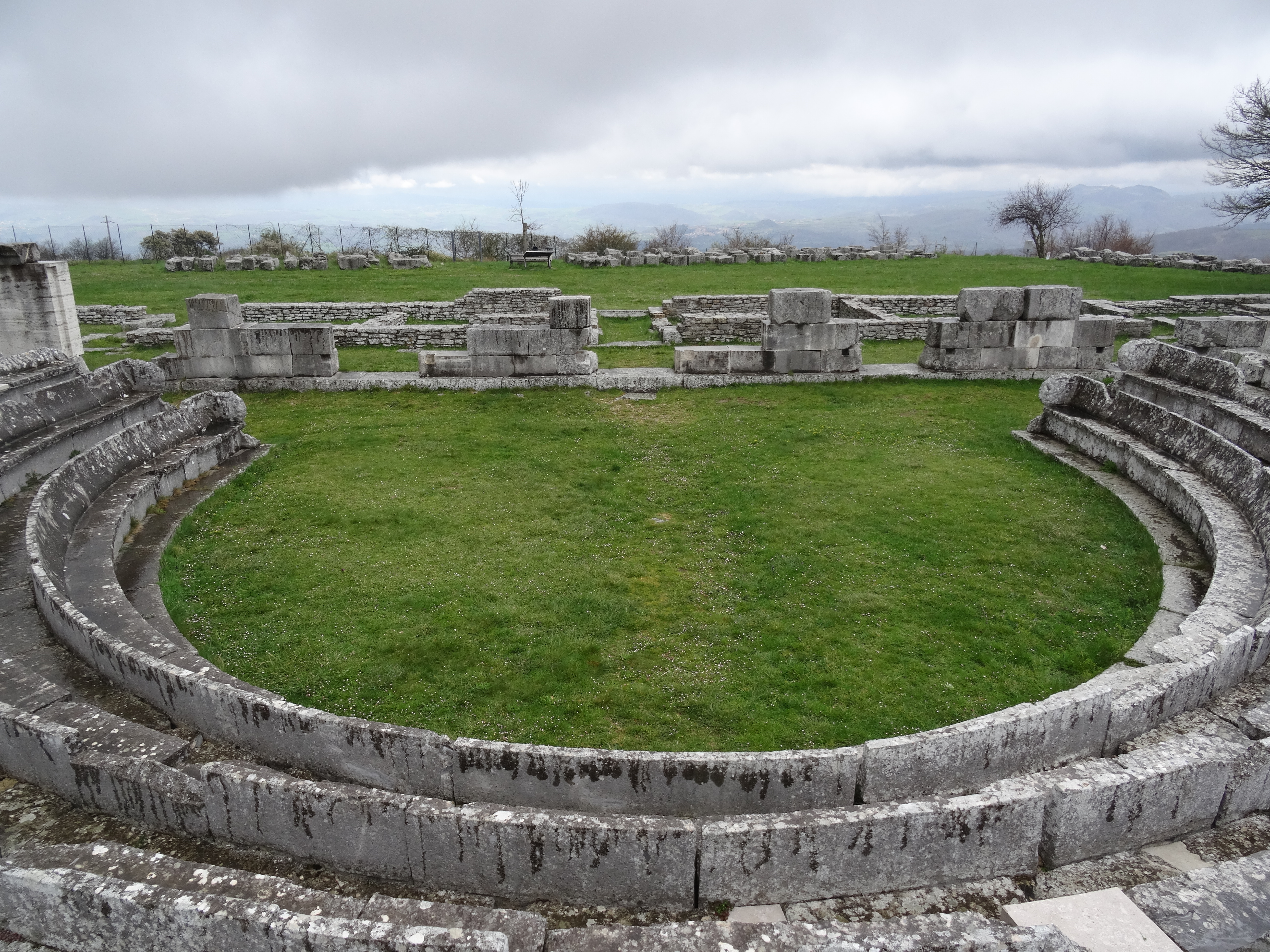
Similarly, many authors have identified Pietrabbondante with Aquilonia, recorded three hundred years later in Livy (10.38) as the site of a brutal swearing-in-cum-human-sacrifice perpetrated by the Samnites in 293 BCE during their war with Rome:
But first they held a levy throughout Samnium under this new ordinance, that whosoever of military age did not report in response to the proclamation of the generals, or departed without their orders, should forfeit his life to Jupiter. Which done, they appointed all the army to meet at Aquilonia, where some forty thousand soldiers, the strength of Samnium, came together. […]
On the conclusion of the sacrifice, the general by his apparitor commanded to be summoned all those of the highest degree in birth and deeds of arms; and one by one they were introduced. Besides other ceremonial preparations, such as might avail to strike the mind with religious awe, there was a place all enclosed, with altars in the midst and slaughtered victims lying about, and round them a guard of centurions with drawn swords. The man was brought up to the altar, more like a victim than a partaker in the rite, and was sworn not to divulge what he should there see or hear. They then compelled him to take an oath in accordance with a certain dreadful form of words, whereby he invoked a curse upon his head, his household, and his family, if he went not into battle where his generals led the way, or if he either fled from the line himself or saw any other fleeing and did not instantly cut him down. Some there were at first who refused to take this oath; these were beheaded before the altars, where they lay amongst the slaughtered victims—a warning to the rest not to refuse. (Translation Loeb Classical Library)
Both Aquilonia and Fanum Voltumnae have been hypothesised to be in different places, though, and there is no complete consensus that Pietrabbondante and Campo della Fiera are the correct locations for the dramatic events described in ancient historical authors, despite their impressive artefacts and buildings.
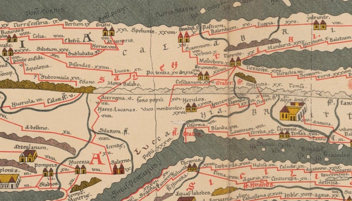
More plausibly, and with more precision about the details, Olivier de Cazanove has hypothesized that the major Lucanian sanctuary of Rossano di Vaglio is marked as a station on the Peutinger Table, a late antique map which may draw on maps from as early as the first century BCE. The name he identifies as Rossano on the map is ‘Lucos’, marked as 12 miles from Potentia – the correct distance for the turn-off one would take from the main road to reach the sanctuary, though not the correct distance from Potentia to the site itself.

Ancient maps described journeys rather than literal spatial relationships (somewhat like the London Tube Map), and it is plausible that this crossroads would be marked with the name of a major sanctuary site that could be reached from there. Sanctuaries were not just major sites for worshipping the gods, but also for markets and other commercial activities – just the sort of thing people would travel long distances to attend, and would potentially need an itinerary to find.
The name ‘Lucos’ is also plausible, as Latin lucus means ‘sacred grove’ – it may be that the sanctuary developed from such a grove, and that the Oscan word was similar to the Latin. Going even further, one could speciuate (as Cazanove does) that the name of this sanctuary might even be the origin of the name of the people of the region – the Lucani.
But what I quite like is the way that even the Italian names have guided archaeologists to look for the ancient past there. ‘Pietrabbondante’ – so called because of the abundance of spolia in the area – is an obvious example. And Campo della Fiera – ‘Festival Field’ – points to a long tradition of fairs and festivals being held on this wide, flat space, certainly in the mediaeval and early modern periods and probably as far back as antiquity.
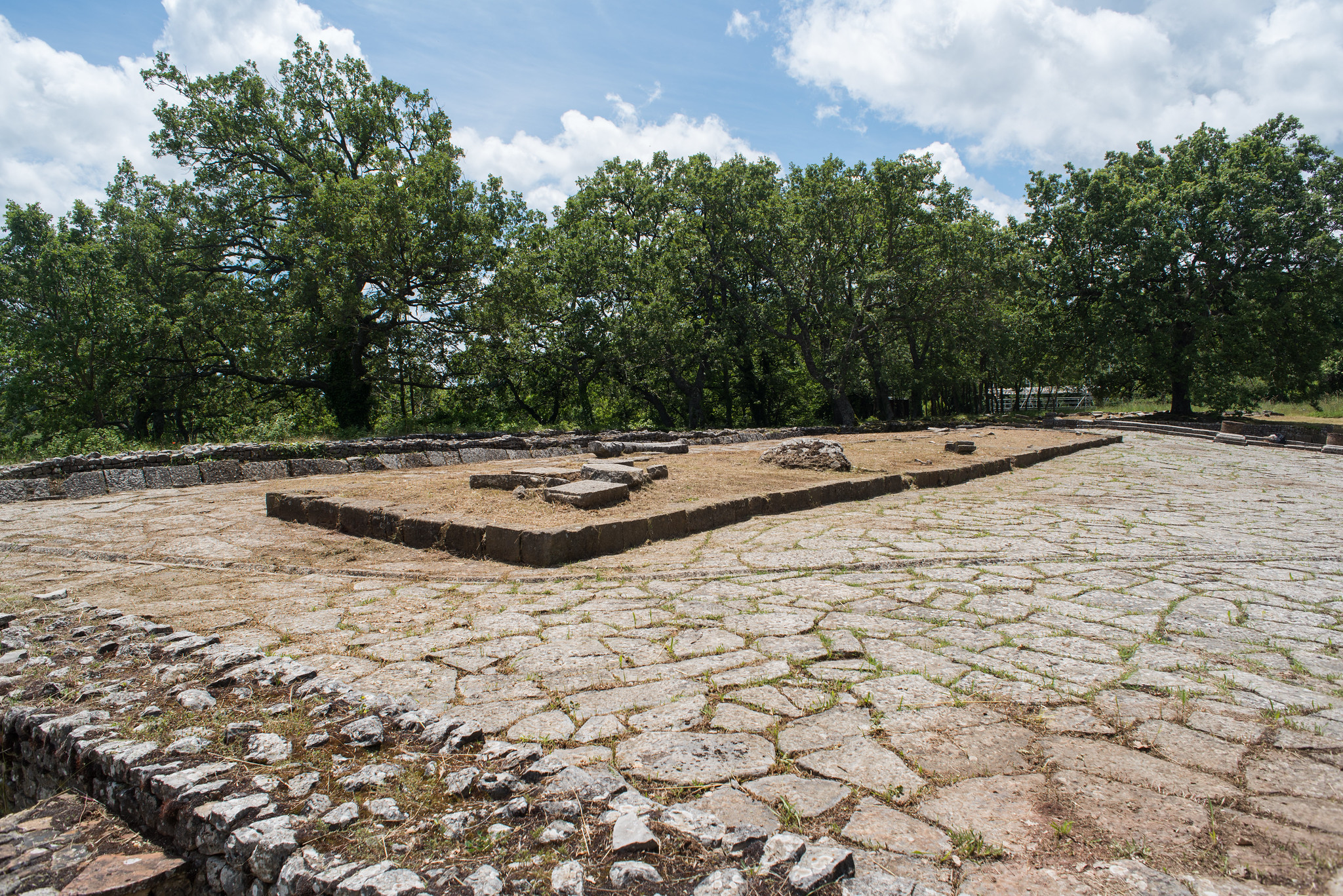
Image of Pietrabbondante (top) by K. McDonald. Image of Peutinger table from Wikimedia Commons. Image of Rossano di Vaglio (bottom) by D. Diffendale.


Leave a comment